


sentier bastidon 999m 17.6k

Danielba
User GUIDE
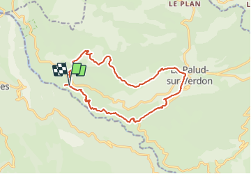

Length
17.3 km

Max alt
1385 m

Uphill gradient
926 m
Km-Effort
30 km

Min alt
707 m

Downhill gradient
927 m
Boucle
Yes
Creation date :
2023-11-19 07:40:20.85
Updated on :
2023-11-19 17:53:12.57
7h41
Difficulty : Medium

FREE GPS app for hiking
 SityTrail
IGN / Geographical institutes
SityTrail Plus
The world is yours!
About
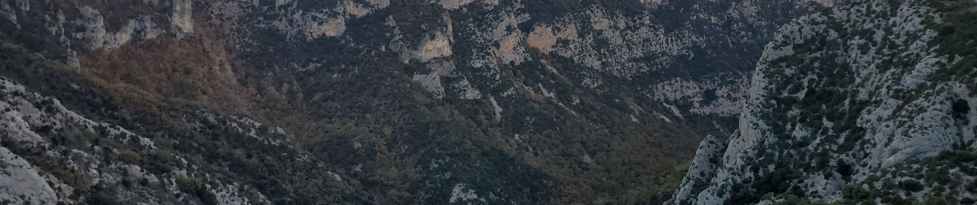
Trail Walking of 17.3 km to be discovered at Provence-Alpes-Côte d'Azur, Alpes-de-Haute-Provence, La Palud-sur-Verdon. This trail is proposed by Danielba .
Photos


Positioning
Country:
France
Region :
Provence-Alpes-Côte d'Azur
Department/Province :
Alpes-de-Haute-Provence
Municipality :
La Palud-sur-Verdon
Location:
Unknown
Start:(Dec)
Start:(UTM)
281284 ; 4850572 (32T) N.
Comments